Where in the World is Bay Fiord?
By Genevieve LeMoineThis is no small task, as anyone who has faced a mountain of undocumented family snapshots can attest. Luckily for us, Donald MacMillan and his associates were pretty good about keeping track of where and when they took their photos, so many of the museum’s collections are well documented. But for a lot of our images, knowing the name of the place they were taken is not very helpful unless you are very familiar with Arctic geography. How many people know where Bay Fiord is, for example? Or Pikiuleq (Littleton Island)?
To help visitors using our online collections visualize where photographs and objects are from we have been busy gathering latitude and longitude coordinates and adding them to our database. When the record for the item is viewed online, its associated location is displayed on a map. To date, we have added locations to over 14,000 photographs and 3,000 objects, representing over 1,000 distinct places. As I write, over 5,500 of these are accessible online, with more being added every week.
For the most part, finding the latitude and longitude for places is simple, a matter of entering the place name in Google Earth, which conveniently displays the coordinates. Thanks to the diligent efforts of two staff members, most locations and many thousands of records were completed this way. The challenge comes when Google Earth does not recognize a place name. Then we must broaden our search, relying on more detailed databases such as the Canadian Geographical Names database or the Government of Greenland map portal.
Not surprisingly, even these do not provide all the answers. Sometimes locations were recorded in areas that were at the time poorly mapped, with few official place names. Some were transcribed from Inuktitut using idiosyncratic spellings. Others were names assigned in the field that were not adopted as official names. And inevitably, some were simple spelling errors. In these cases, a combination of luck, familiarity with local geography, and detective work often allows us to pinpoint a location.
When a simple Google search does not reveal an answer, scanned versions of historic Pilot Books were incredibly helpful. These are official documents that describe coastlines in great detail to assist in navigation. MacMillan carried them on the Bowdoin along with charts (and indeed contributed to them). Pilot Books describe all sorts of coastal landmarks in a broader context, making it possible to find obscure places, and their current names, on a modern map.
Many photographs were taken “at sea”, or on sledging expeditions on the sea ice. These we have chosen not to locate precisely, unless we have very good contextual information, such as Games on the Polar Sea, for which MacMillan reported a precise location. In rare cases, we can use the information in our database with other sources to find a location. We have a few photographs of Fletcher’s Ice Island, also known as T-3. It was a long-term research station on a huge floating ice pan, used between 1952 and 1978. The track of T-3 as it drifted in the Arctic ice pack is well-documented, and since we know the month and year our photos were taken, we can find their associated locations in the Arctic Ocean.
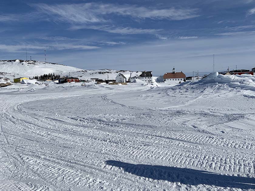
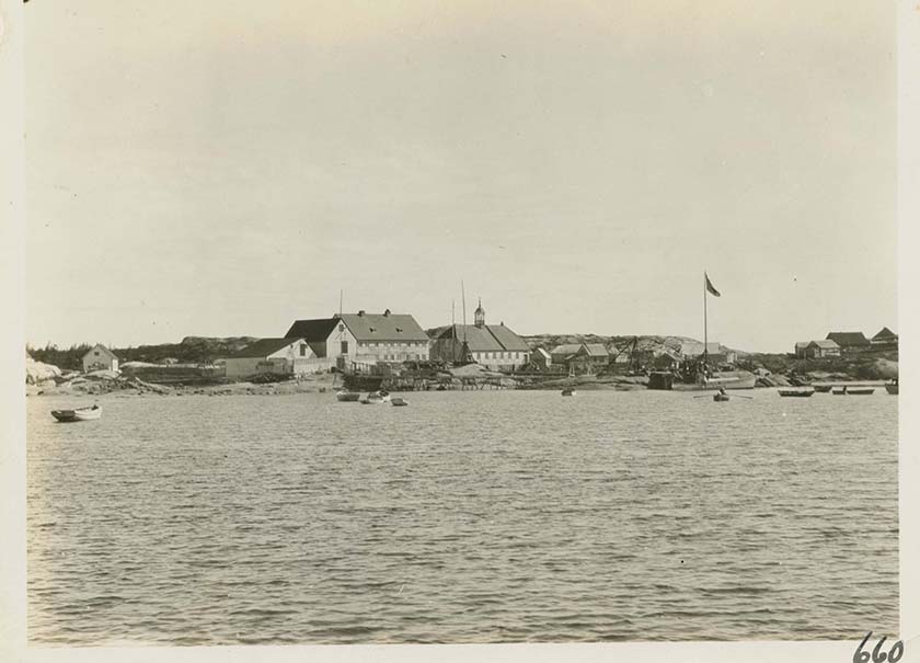
There is one other way to find locational coordinates for an image: go to the spot and take a photo with a modern device! This is not the most practical approach, but it is certainly the most fun. In the spring of 2019 we were fortunate to be doing some research on the coast of Labrador and captured this image of the town of Hopedale, with its distinctive Moravian Mission buildings, while walking on the frozen bay in front of the town. MacMillan took a similar image from the water in 1931.
Fun with locations
Our database requires that we use “decimal degrees” to identify locations. These are the familiar longitude and latitude numbers, but instead of each degree being divided into 60 minutes that are each made up of 60 seconds, they are divided into tenths, hundredths and so on. This makes latitude and longitude information easier for computers to deal with.
There are other systems for precisely locating a spot on the earth. One of the newest, and most innovative, is What3Words. This system divides the whole globe into 3m squares and assigns three words to each. There are many valuable reasons for doing this, but it is also simply a lot of fun. A 3m square is not very big, so a geographic feature, or even a building, can have many possible identifiers. Finding one that resonates can be an interesting game! This morning I navigated to Etah on their map, to see how it was identified. The first set of three words I got was “madmen.banish.chronicled” (you will have to zoom way out to see where this is). Check out MacMillan’s account of the Crocker Land Expedition, Four Years in the White North, to find out why this is such an appropriate locator! Then, do some exploring of your own. Can you figure out why this location, ///unheated.gatherings.solved means a lot to me? What interesting places/3 word- combinations can you find?