
Researchers on New Brunswick’s Kent Island have wondered for decades where the island’s breeding Leach’s storm-petrels disappear to for days-long stretches of time. Not knowing the birds’ foraging destination has limited conservationists’ ability to advocate for protections for the small, long-lived seabirds, whose numbers are in decline on Kent Island and around the world.
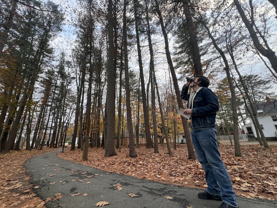
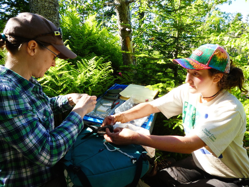
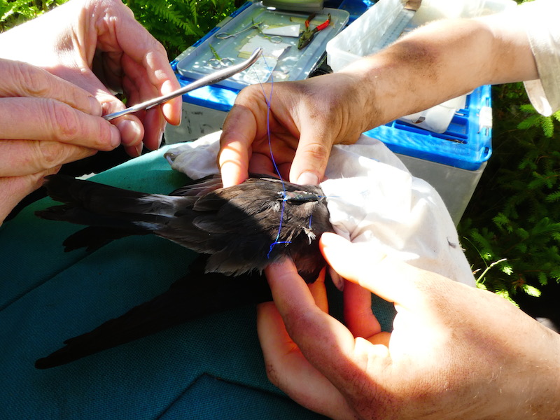
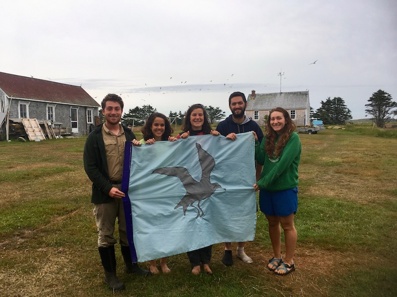
This summer, a Canadian organization outfitted Kent Island petrels with more than a dozen tiny backpacks carrying GPS devices. With help from her students, Patty Jones, director of the Bowdoin Scientific Station on Kent Island, selected which petrels would wear the packs, and assisted in attaching them.
After two weeks, Jones and the students collected packs from eleven of the birds that returned, mailing the tiny cargo back to Laura Tranquilla of Bird Studies Canada for analysis.
Tranquilla’s findings back up data from a previous study conducted in 2013 and 2014 on Leach’s storm-petrels in the Northwest Atlantic by a researcher with Environment and Climate Change Canada.
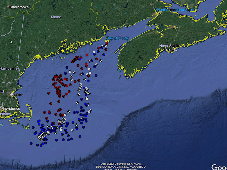
“They fly from Kent Island all the way down, past Brunswick, to Cape Cod to find food,” Jones explained. She has written about the GPS-aided discoveries on her blog. “The trip takes them three or four days, then they return to Kent Island and trade out with their mate who was sitting on their egg in their little burrow in the ground, so that their mate can head out and find food.”
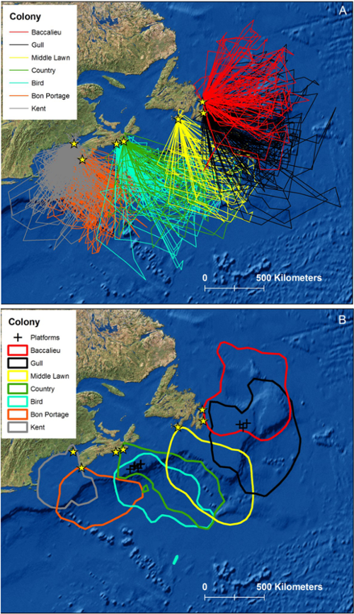
While the majority of Canada’s storm-petrel population breeds on the Maritime islands and forages in deeper ocean waters to the east, the Kent Island population — the species’ southernmost colony — heads to the warmer, shallower waters off Cape Cod to hunt for small fish and krill.
This choice of foraging area may pose additional risks in a life already filled with dangers. Because Leach’s storm-petrels breed in underground burrows, they are easy prey for predators, like rats, weasels, cats, mink, and otters. They are also vulnerable to environmental toxins and climate change. In twenty years, Kent Island’s population has dropped thirty percent, which mirrors the overall global decline of this seabird.
The new GPS data is critical information to have to influence fishing policies or to support other efforts to protect petrels, Jones said. “It is really important for us to know where they are foraging, as rising sea temperatures and resulting declines in fish and crustacean availability are believed to be the cause of declines,” she said.” The rapidly warming waters in the Gulf of Maine — the fastest changing ocean body in the world — might be leading to a decrease in fish, or pushing petrel prey farther out to sea.
While Jones said the findings from the GPS are exciting because they fill a knowledge gap, she also pointed to another conclusion from the data. “I’ve been thinking of our little birds on this tiny island, and how these findings highlight really nicely how linked we are,” she said. “Even though we’re way out here in the Bay of Fundy, which seems really far away, we are linked by these birds. Every day there are petrels from here foraging off Brunswick and heading back up to Kent Island.”
Follow all the summer research on Kent Island on Instagram, Twitter and Facebook @bsskentisland.