True to his liberal arts background, junior Angus Gorman’s academic pursuits cover a lot of bases. He’s a computer science and classics major, but over the summer he’s been immersed—if that’s the right word—in the challenges of putting together a reliable coastal flood map. As a Rusack Coastal Studies Fellow, Gorman said he has not been directly involved in the creation of maps themselves, “but in creating free, open-source software that makes maps.” It’s an important and timely subject, said Gorman, affecting a lot of ordinary people, including many here in Maine. In the wake of rising sea levels and climate change, federal agencies are currently in the process of remapping much of America’s coastline to recalculate flood insurance rates.
“The US government has the FIRM program, which stands for Flood Insurance Rate Maps, which is mapping every coastal county in the nation,” said Gorman.
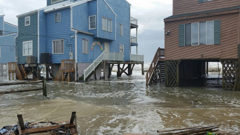
But the licensed software the government uses has encountered numerous problems, he added. “For example, when mapping smaller areas the software doesn’t take into account geographic features that are outside the scope of the map.” This, he explained, means that some maps have a tendency to be inaccurate by failing to consider a river or watershed that happens to be near, but outside, the map’s boundaries—potential flooding that no one is aware of.
Gorman’s summer research, which he did under the supervision of Associate Professor of Computer Science Laura Toma, and Lecturer in Environmental Studies Eileen Johnson (who is also program manager at the department), is part of an ongoing effort with some pretty lofty goals. “We want to come up with a program that can replace the government one,” said Gorman, “and there are two major factors in our favor at the moment. The first is that this is a hands-off program, meaning you can plug it in, input the parameters, and go off an do something else, and come back later, whereas the government software is very labor intensive and requires a lot of manual input.”
The program’s other selling point, said Gorman, is its aim to incorporate sea level rise into the maps. The software program should enable existing maps to adapt themselves to the rising sea level, he said, rather than requiring a whole new map to be drawn up. “We also employ the ‘decay factor,’ to replicate the effect a wave hitting the coast will have as it goes inland.”
Gorman has achieved his summer goal of having software and algorithms that work at a basic level. But he admitted the project is still a long way from being usable and is very sensitive to input size. “The software right now runs on small models,” he said, “and we still have not run the program on a larger-than-county scale.” Another challenge is the amount of memory the computer program requires. “It uses ten to twenty gigabytes, and the best computers here have about sixteen gigs of RAM, so we would be going into the hard drive a lot, and this drastically increases the run time. So if we can find a way to eliminate one third of that, which is within our grasp, it would be huge step forward.”
Gorman hopes to continue working on this again next summer, and as an independent study project in the fall of his senior year. His more immediate goal, however, is to successfully showcase a working computer program at the annual President’s Science Symposium later this fall. “We are hoping some federal and state officials will be able to attend so we can show them what we’ve done so far.” The project has had no outside funding, said Gorman, but he and supervisors have received guidance from officials at the Maine’s Floodplain Management Program and the Maine Geological Survey, as well as staff from the National Oceanic and Atmospheric Administration (NOAA), which is one of the federal agencies involved in the re-mapping of America’s coastline.