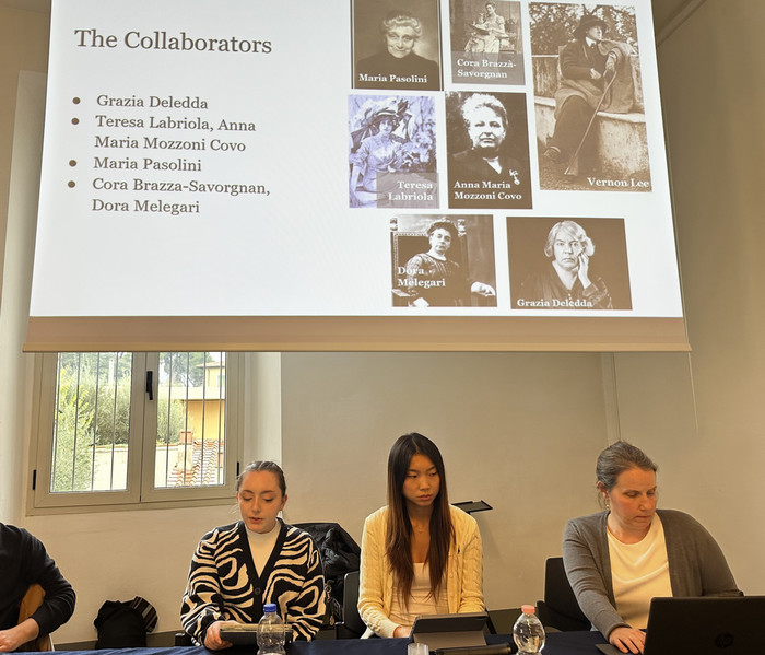
By Kathleen Johnson ’19
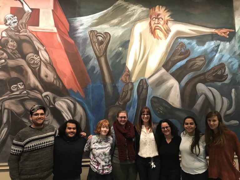
My Hispanic Studies class, Mexican Fictions: Voices From the Border, taught by Associate Professor of Romance Languages and Literatures Carolyn Wolfenzon Niego, earlier this month drove to Dartmouth College to tour José Clemente Orozco’s murals in the college library. Having no familiarity with the murals beforehand, I was struck by the fact the they were painted in the fresco style, meaning that the pigment is actually mixed into the plaster rather than lying on top of it. This also meant that Orozco had relatively little time to actually paint each section before the plaster dried. Our guide and host, Mary K. Coffey, pointed out the visible lines of demarcation where Orozco finished painting one day and started the next with slightly mismatched colors, telling us that Orozco didn’t care if the shifts were visible, since he wasn’t trying to paint in a realistic style. Coffey, an associate Professor in Art History at Dartmouth, has published extensively about the murals.
The mural, The Epic of American Civilization, is separated into two “wings,” one representing the ancient Mexico and the other representing the modern era, the break being defined by the departure of the deity Quetzalcoatl and the arrival of Cortez and the conquistadores. The two halves are separated by the alcove for the actual reserves desk for the library, and I thought it was great that Orozco took that feature, what some artists would see as an annoying obstacle, and instead used it to further the narrative of his art, using the physical breakup of the room to represent the drastic break between the ancient and more recent times.
The title of the mural was also intriguing to me, because the scenes depicted in the murals (Aztec sacrifice, step pyramids, a figure resembling Zapata or Pancho Villa) clearly come from Mexico, and in the U.S. we have a tendency to mean only our own country when we refer to “America,” excluding the rest of the continent. By titling his work that way, Orozco was making an argument about the unity of the Americas, and how he thought the U.S. and Mexico should view each other. We saw that argument in the murals themselves; for example, in one scene depicting an Anglo-American schoolteacher, an archetypal red schoolhouse and little white church are painted in the background. In the next scene, which is centered on the Mexican Revolution, the same red-and-white motif is reflected with a white Parthenon-like structure and red office building, which I took to be a mark of how the two countries are made of many of the same components, even though the way that mutual history exists in their cultures is distinct.
The trip came at a fitting time, since we had just finished reading Señales que precederán al fin del mundo (Signs Preceding the End of the World) by Yuri Herrera, where the protagonist, Makina, crosses the U.S./Mexico border and describes the disparities in culture and atmosphere that she feels after arriving in the U.S., a division that I could see Orozco addressing in his murals, although they were painted decades before Herrera’s book was published.
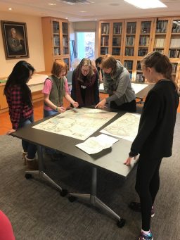
We followed up our Dartmouth trip with a visit to Bowdoin’s Special Collections & Archives, where we got to examine maps of the U.S./Mexico border that went as far back as the mid-1800s, and we discussed the ways that the border was represented and how that reflected the position of the mapmaker. A New York company publishing a map in Spanish could be making a statement by still using English miles for scale. A map with individually shaded U.S. states but homogenous grey Mexican states could indicate the cartographer’s view of their relative importance, just as Orozco’s use of mirrored colors marked his, and I am grateful that we got to see them all.