Adding pictures to the CBGIS database
Pictures should be placed in the CBGIS\Volcanics Project\year of sample if they are field photos and CBGIS\Volcanics Project\microfolder if they are microscope photos.
If the pictures you have are from a year without a folder already, make one and place them it that folder.
Once pictures have been placed in the correct folder and added to the database notify Rachel Beane of which pictures you added so she may update the website.
Also add the pictures to the database following instructions here
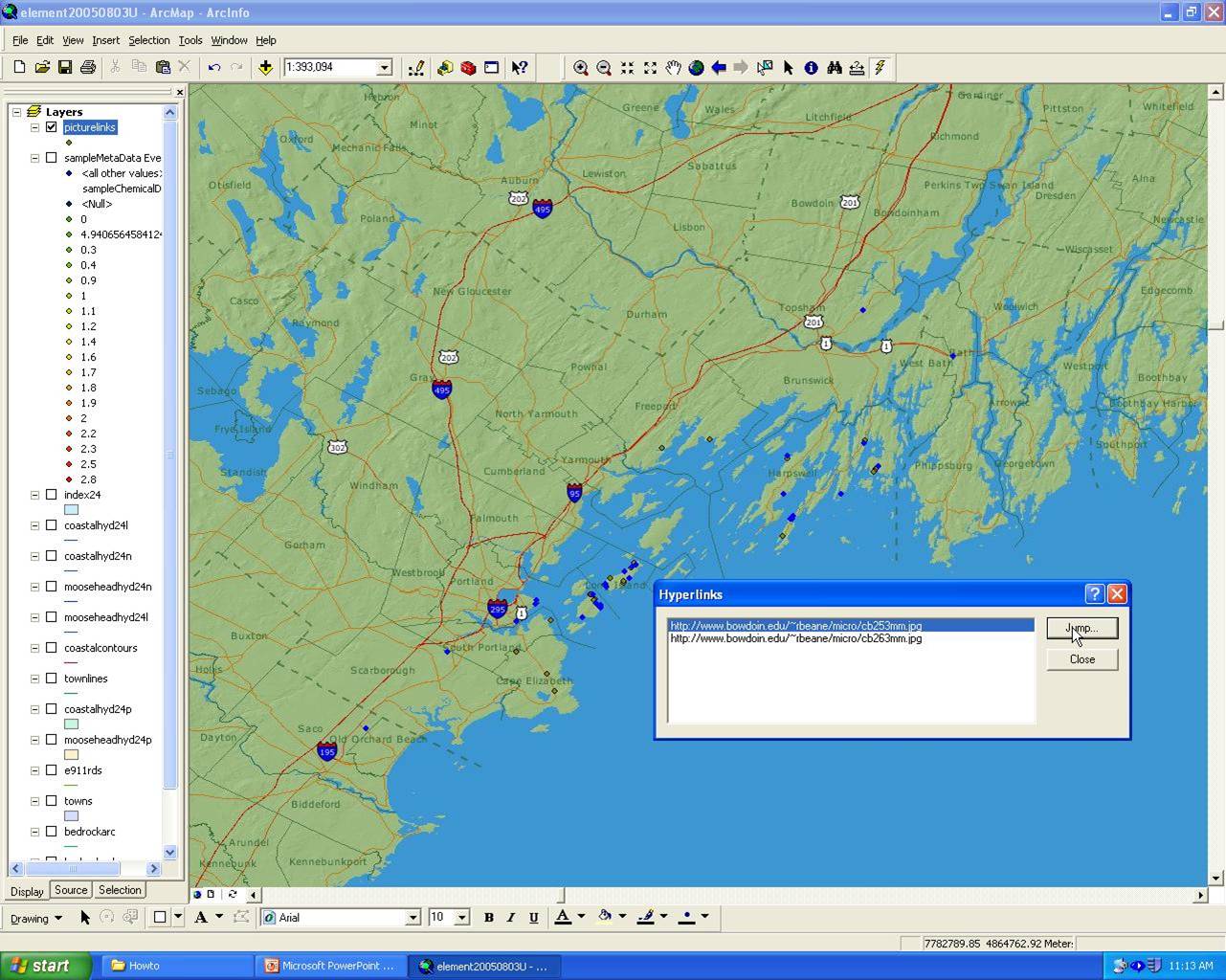
Once data is in the database, you may link these points to photos on a ArcMap document.
Linking Points To Photos
Add the table you are using for photos to ArcMap ie SampleFieldPhotos(field pictures) or SampleMicroscopePhotos to your map.
Join the table(s) to your sampleMetadata table based on SampleID
To get the data from the tables displayed on the map as points select Add XY data from the tools menu. Lat/Long are fields in sampleMetadata. ArcMap usually selects the correct fields for X and Y.
Select the table you just joined
Make sure the coordinate system is North American Datum 1983, found under Geographic, North America when editing coordinate system
Make a new shape file in ArcCatalog
In ArcMap right click on the layer with the hyperlink data, export to the shape file you just made
Add the shape file to the map you are working with
Right click on the shape file, properties, display tab, support hyperlinks
Once back in the data view, click the lightning bolt icon and then click on one of the points that has a picture associated with it. Select the photo then click Jump. This will open it in a new web browser. You must have a web browser set as a default for the links to work.