Moving Data to ArcGIS
There are multiple ways to add data from the geodatabase to ArcGIS. For the first method go here. This will show you how to use data in the database in GIS.
To move data from the database to ArcGIS by making files that do not require access to the database takes a little bit of work.
First you need to move the data into tables. Open up the geodatabase in Access, select the records you want and then click file, export. Export the data as a .csv text file. You can then open ArcGIS, add the table.
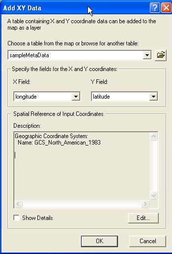
Once you have added the tables you want join them based upon sampleID. You need to have the metadata table added to display the data as points. You will then want to Add XY data which is found in Tools, choosing lat and long fields for you X and Y coordinates. It should do this automatically but sometimes it does not. The coordinate system is North American Datum 1983, found under Geographic, North America when editing coordinate system. Once you have added this as XY data each sample site should show up as a point on the map.
IMPORTANT: remember that this data will not update as the database updates since you have exported it as a separate file. You will need to redo this process any time you need to refresh this data after new samples have been added.