These maps are intended to introduce students to the physical distribution of the antebellum black population, and orient them geographically for the remainder of the lesson. Instructors may show the following maps to the class as a whole, and solicit student reactions.
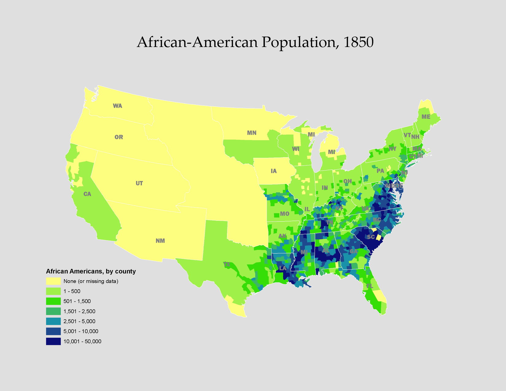
Map 1: African American population, 1850
Questions:
1. Where did the bulk of the African-American population live in 1850?
2. What might account for these settlement patterns?
3. Where in the Northern states was the African-American population concentrated?
Map 2: Percent of population African American, 1850
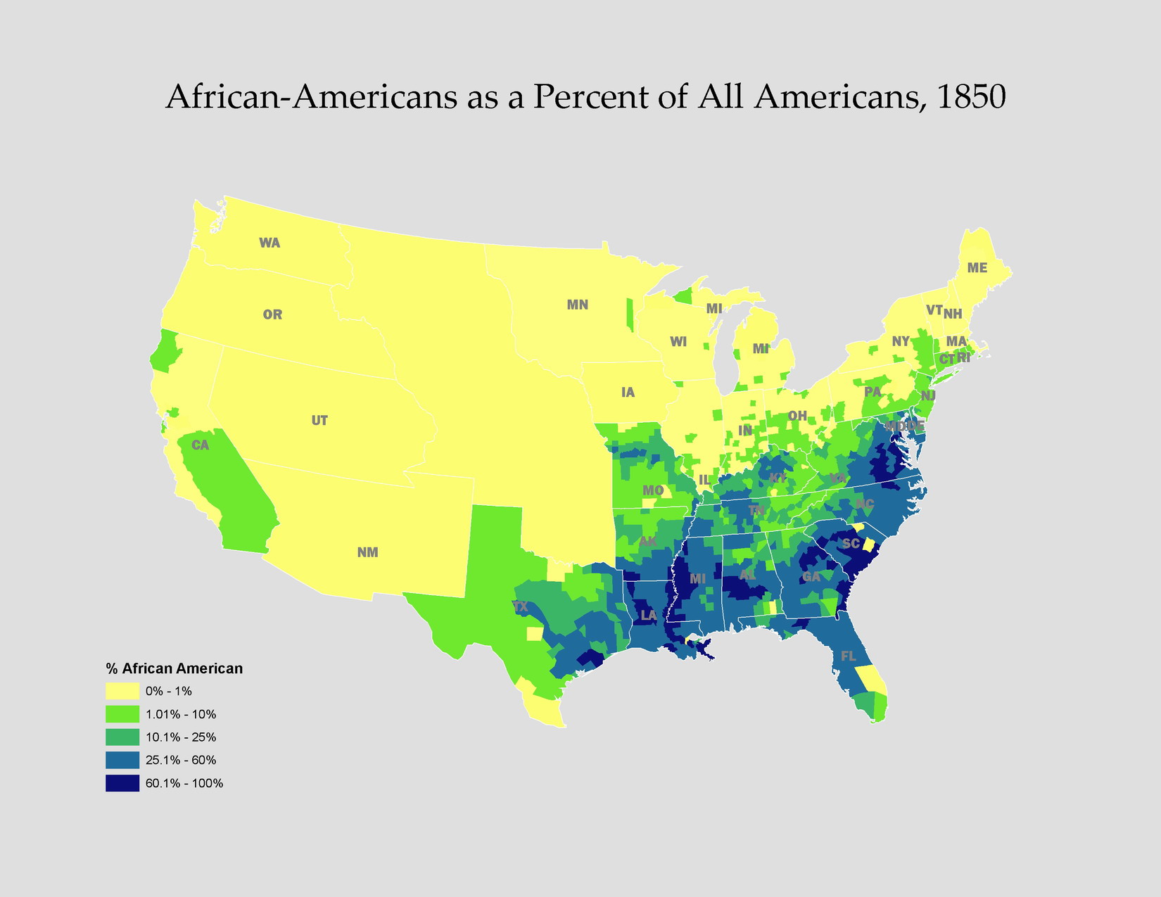
Questions:
4. How does this map differ from the last?
5. Where did African Americans comprise the largest percentage of the general
population?
6. How concentrated were African Americans in the Northern states?
Map 3: Percent of African-American population free, 1850
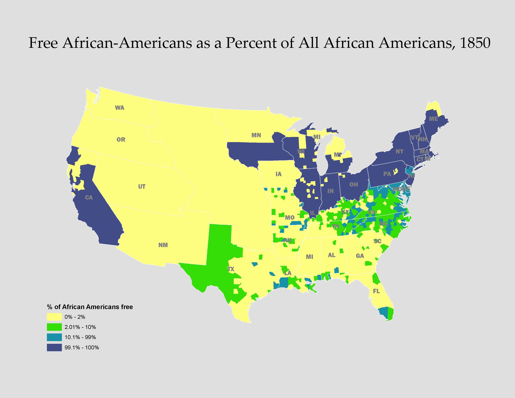
Questions:
7. Where did the bulk of free African Americans live in 1850?
8. What factors may account for the distribution of the free black population?
9. What factors may account for the concentration of free African Americans
in the southern population?
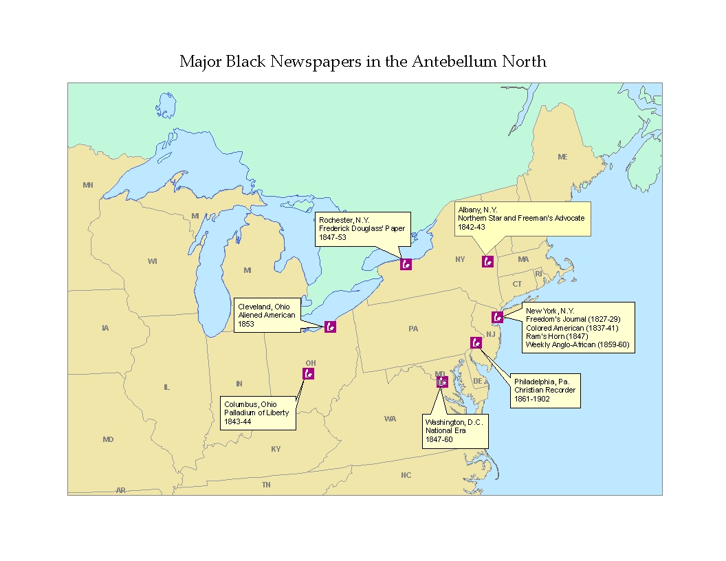
The following maps are additions to the published lesson plan. They illustrate aspects of free black life before the Civil War. Instructors may wish to discuss these with students after a quick perusal of textbook material on the subject of each map.
Map 4: Black newspapers in the antebellum North
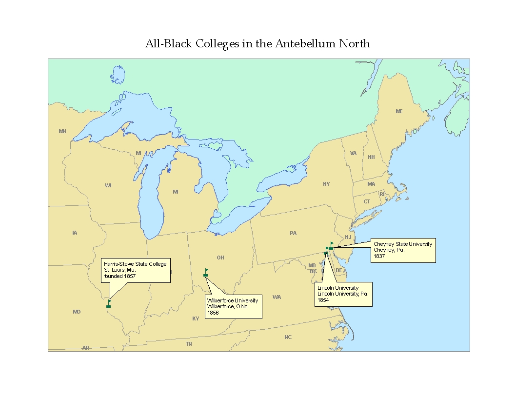
Map 5: All-black colleges in the antebellum North
Map 6: Race riots in the antebellum North

Map 7: Fugitive slave rescues in the antebellum North
