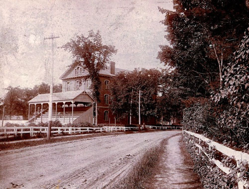
A view of the road that used to run directly behind Adams and Mass Halls
Access: Always available.
Directions: Walk to Massachusetts Hall and then proceed around the building to the right
and face toward the First Parish Church.
GIS: 43° 54‘ 35.16“ N --- 69°
57‘ 42.50“ W
---Photos follow--
Long before the College sprang up, Twelve Rod Road used to run from Brunswick Falls all the way down to Maquoit Bay, passing through just behind where Massachusetts Hall sits today. At the time that the land was set aside for the campus, several squatters and would-be settlers were living in the area around the road. When surveyors came in to measure the campus, they received a very unfriendly welcome. The squatters tried to scare them off and even killed and mutilated two of the surveyors' horses to try to get them to stay away.